


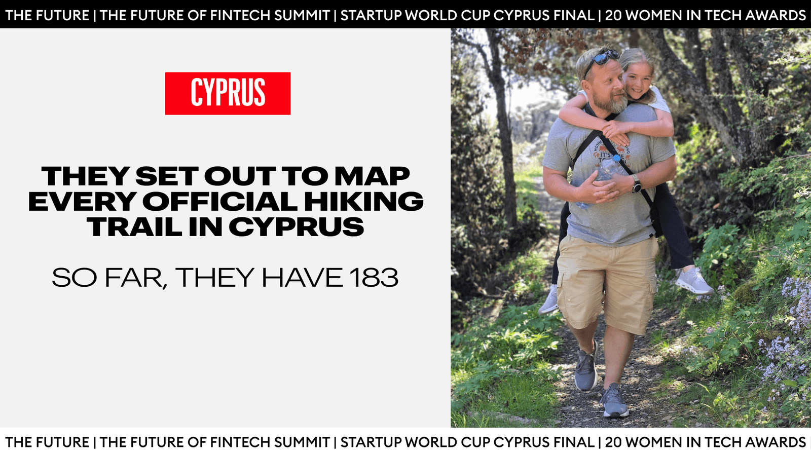
Ivan Agafonov and Vladimir Bugay know Cyprus’ hiking trails better than almost anyone. They built the island’s most comprehensive database of official routes, manually traced nearly every GPS track and, between them, have covered more of Cyprus’ terrain than most lifelong residents. Yet even Agafonov, who made it his mission to visit every official trail after moving to the island, was surprised to discover that he had completed only 30% of them.
The idea to build a database came to Ivan Agafonov after years of weekend trails across Cyprus with his son. The triathlete tech executive started wondering how many official hiking trails Cyprus actually had. Not those rough paths worn by donkeys or shortcuts across “xorafia”. The trails with a proper wooden signboard, a name, and a mapped-out route. He started counting, and even a year later, the number kept growing.
Follow THE FUTURE on LinkedIn, Facebook, Instagram, X and Telegram
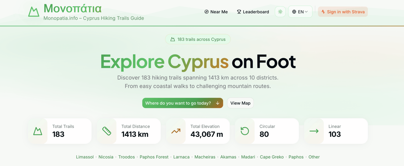
What he built from that question, alongside entrepreneur Vladimir Bugay, is Monopatia, a free, no-signup web platform cataloguing 183 verified hiking trails across the island, covering 1,413 kilometres and 43,067 metres of total elevation gain. It costs nothing to use and earns nothing for its creators. It is also, by a significant margin, the most comprehensive public guide to hiking in Cyprus that exists.
The Problem With “Just Google Map It”
Ivan Agafonov arrived in Cyprus in the Autumn of 2022. He found a home in Louvaras, a mountain village around 30km from the centre of Limassol, known for its quality of koumantaria. With 15 years in triathlon and a PhD in Physics that left him inclined to structure and spreadsheets, he wanted to know the full scope of what the island offered (and keep a record of all he had visited).
When he began to research potential hiking trails to explore, he found himself getting lost in the process. “It’s very fragmented,” Agafonov says. “Some are well-documented, but some are barely findable.”
The Forest Department maintained its own list. Paphos city had its own portal. Pissouri had its own trails. None of the existing databases linked to each other, and none of them were complete. Some trails had maps that, when cross-referenced against the actual wooden signboards at the start of the actual trail, turned out to be wrong.
He started a Notion table. For each entry he located a photograph of the physical signboard to confirm the trail existed in real life, rather than relying on a webpage. From there he manually traced each route in Strava, clicking through point by point. The database grew to over 100 trails, and Ivan decided to share his database publicly with some of the local online hiking groups.
The Notion table worked, but only just. With 100-plus trails and no map, navigating the data was still a chore. A list of trail names and coordinates means very little when you are trying to decide where to take your family on a Saturday morning. What he needed was someone who could turn the database into something visual, something you could actually navigate and use.
That’s when he came across Vladimir Bugay’s work Fragmata, a project visualising Cyprus’s water reservoir data that found unexpected traction among English- and Russian-speaking communities on the island. “I actually was using Ivan’s Notion database for a while to pick trails,” Vladimir Bugay says, “but it was not easy to navigate.”
The two met through a Telegram hiking group. Agafonov reached out to Bugay about potentially building a map interface. Bugay had just finished Fragmata and was already thinking about taking on a new project, and as fate would have it, one of them was on the topic of trails. “It was kind of an instant match,” Agafonov recalls. “Quite an interesting coincidence that we approached this idea from different sides.”
100 Hours. 183 Trails. One Standard.
The resulting platform reflects Bugay’s engineering instinct for intuitive design and simplicity, and Agafonov’s refusal to publish anything he hasn’t verified himself.
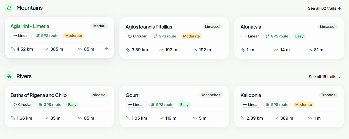
What they co-created became the platform Monopatia, which asks nothing of its visitors to use, no sign-up fee or even account setup. It’s as simple as opening the site on a phone, filtering by district, difficulty, or type (mountains, rivers, canyons, churches, bridges, dams, caves, waterfalls, monasteries) and downloading a GPX file directly to a watch or phone. The whole interaction takes under two minutes.
Behind that simplicity is a quality standard that sets a high bar from the start. Agafonov estimates the database took at least 100 hours to build. For each of the 183 trails, he created the GPS route manually in Strava, trace by trace. “By doing so, I can guarantee that 99% of the data is accurate, at least within the original map,” he says. “If there are any mistakes on the map, they will be translated to the digital road, but as far as it goes, it’s not just unverified data someone grabbed from the internet without checking.”
“Ivan is very comprehensive. I sincerely doubt there is anyone in Cyprus (maybe in the world) who knows Cyprus trails better,”
Bugay says.
The leaderboard feature, which tracks completed trails, delivered a reality check to both. Agafonov had assumed he had hiked at least half the island’s official network. The data put him just under 30%. Bugay had the same (surprising) humble reckoning.
“You need to spend a few years, every weekend, just to visit a majority of them. Not even all. He ran the numbers: one trail per weekend, every weekend, comes out to 3.4 years before you finish”,
Agafonov says.
What AllTrails and Wikiloc Got Wrong
Both Agafonov and Bugay tried to use already existing global platforms to keep track and discover new trails, but could not find one that worked well enough for the Cypriot context.
AllTrails, the dominant global hiking app, has almost no usable coverage of Cyprus. “When it comes to site coverage, it doesn’t work well for Cyprus,” Bugay says. “It’s understandable. These larger platforms are not really paying a lot of attention to not-so-popular destinations.”
WikiLoc, another popular trail upload tool, has the opposite problem. Hundreds of overlapping user-generated tracks layer on top of each other, with no way to distinguish a maintained Forest Department trail from someone’s personal detour. “It’s, in my opinion, unusable,” Agafonov says. “It’s difficult to tell apart the good and the bad ones.”
An Island Smaller Than It Seems, and Larger Than People Think
The most common complaint from local hikers is that there is nowhere left to go. The island is too small.
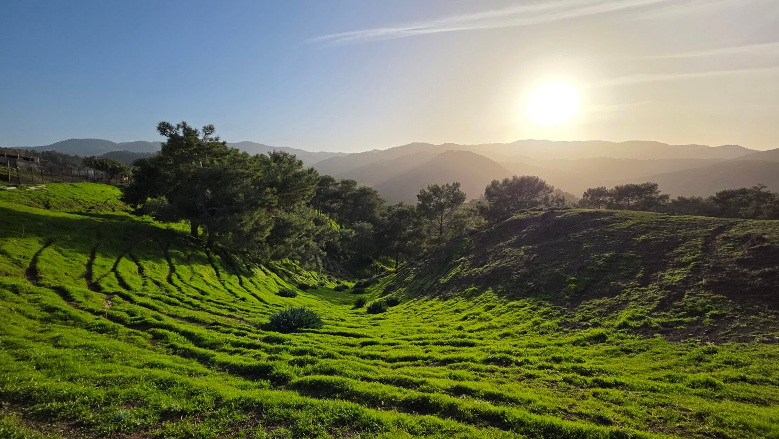
Agafonov has little patience for this. At 183 trails (and still counting) across 10 districts, from Cape Greko’s sea caves to the cedar valleys of the Paphos Forest, the island is substantially larger on foot than it appears from a beach lounger.
The platform also serves a need that is easy to overlook. Families with young children, who cannot risk an ambitious route based on vague online descriptions, get kid-friendly trails that are graded appropriately. Agafonov’s motivation for building the database in this way grew in part from weekend hiking with his 11-year-old son, getting him away from screens and into the forests above Louvaras. The elevation profile, the distance, and the GPS route are all visible before you leave the car park. You see the data, and you decide.
“We help people make informed decisions, giving them extra information which is reliable,”
he says.
Giving Back, Without A Grand Plan
Neither Agafonov nor Bugay follows a product roadmap. One idea for the future that is under active discussion is printing QR codes linked to Monopatia trail pages and fixing them to the official wooden signboards, including the many whose original QR codes now lead nowhere. That would require cooperation from the Forest Department, which both founders say they would welcome.
The forest network is well-maintained and largely well-marked. What it lacks is a digital infrastructure that matches the quality of its physical one.
“The majority are well-maintained and well-marked. It’s a lot of work which may not necessarily be generally appreciated,”
Agafonov says.
But both men are more than willing to take this task on, giving back to a community that took them in. Both arrived on the island understanding that contributing something useful was part of the exchange, a gift that keeps on giving.
“If more people go outside, the more responsible they will be,” Agafonov says. He watched similar changes happen in Russia over two to three decades through his work with non-profits in the triathlon space. He thinks the same arc is possible here.
Monopatia is free. It always will be. The trails are there, marked and mapped and verified, for anyone who wants to find them.
Monopatia is available at monopatia.info.